
The Sequence
Ten Steps, Every Site
- 01
Plan Review and Quantities
We take your civil plans, geotechnical report, and SWPPP into 3D takeoff software. That gives us cut/fill balance, haul routes, and a sequence built backward from your vertical start date.
- 02
Existing-Conditions Capture
Drone photogrammetry and LiDAR map the site. GNSS RTK rovers set control. On tight urban lots, a robotic total station handles shots where satellites can't reach. Existing utilities are located through 811 and ground-penetrating radar before any digging.
Drone + LiDARGNSS RTKRobotic total station - 03
3D Site Model
Design surfaces, pads, and utility profiles are built into one model and loaded directly into the machines' grade-control systems.
- 04
Mobilization and Protection
Erosion controls, construction entrance, tree protection, and an excavation and shoring plan are in place before the first bucket.
- 05
Clearing and Mass Excavation
Dozers and excavators run 3D GPS machine control, cutting to design grade without waiting on stakes. Over-cut and rework drop sharply.
3D machine control - 06
Pad Build and Compaction
Subgrade is prepared and proof-rolled first, because everything above it depends on it. Select fill is then placed in controlled lifts. Each lift is assessed for moisture and material, compacted with intelligent compaction rollers that map stiffness across every square foot, and certified by third-party density testing before the next lift goes down.
Intelligent compactionThird-party density testing - 07
Utilities
Trenches are cut with GPS-guided excavators. Gravity lines are set with pipe lasers. Every fitting and service is shot for as-builts before backfill.
- 08
Roads and Subgrade
Motor graders with 3D control cut subgrade and base to tolerance. Stabilization and proof-rolling follow before paving.
- 09
Progress Verification
Regular drone flights compare built surfaces against the model. Owners get volume reports and imagery, not estimates.
- 10
Finish Grade and Closeout
Final surfaces, compaction certifications, as-built drawings, and a site orthomosaic are delivered in one package.
The key ingredient in a rock-solid foundation is the subgrade.
When the Site Is Complex
Built for the Hardest Urban Work
- Deep Excavation and ShoringEngineered for the soil, the slope, and the neighbors.
- Site-Specific Concrete Retaining WallsDesigned and built for each excavation, not pulled from a catalog.
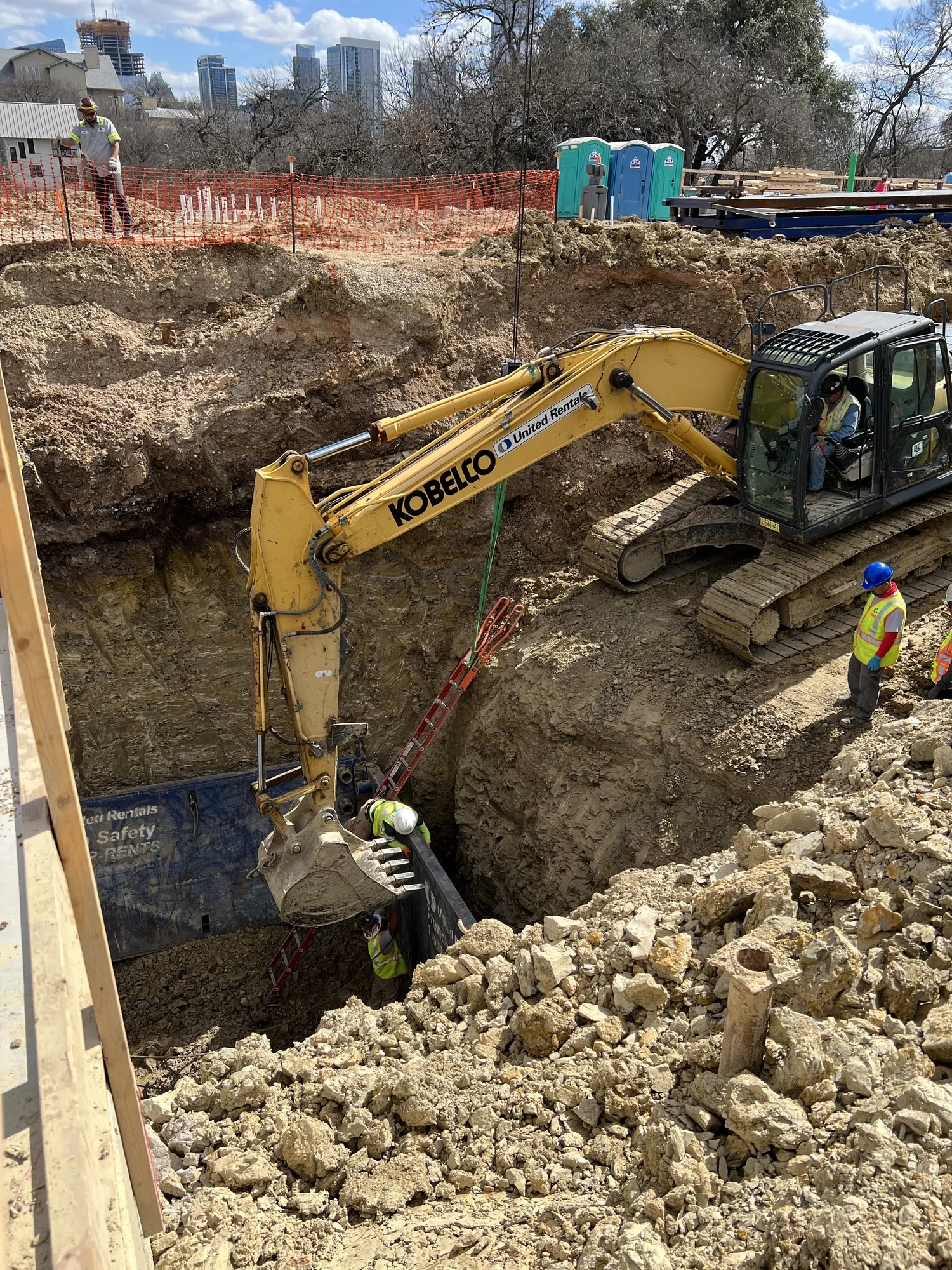
- Subterranean Retention StructuresDeep, walled excavations with code-compliant concrete retention reservoirs and rainwater tanks set inside, as deep as 32 feet below grade.
- Crane-Lowered Mini ExcavatorsTo finish the bottom of deep, confined excavations where full-size machines can't reach or operate.
- City CoordinationPermitting, inspections, and storm water review on dense urban lots.
The Technology Behind It
Measured, Modeled, Proven
GNSS RTK base and rovers, robotic total stations, drone photogrammetry and LiDAR.
3D GPS grade control on dozers, excavators, and motor graders (Trimble, Topcon, Leica).
Intelligent compaction rollers with GPS-mapped stiffness, backed by third-party density testing.
811 coordination and ground-penetrating radar.
3D site models, quantity takeoff, and cloud-shared progress reports.